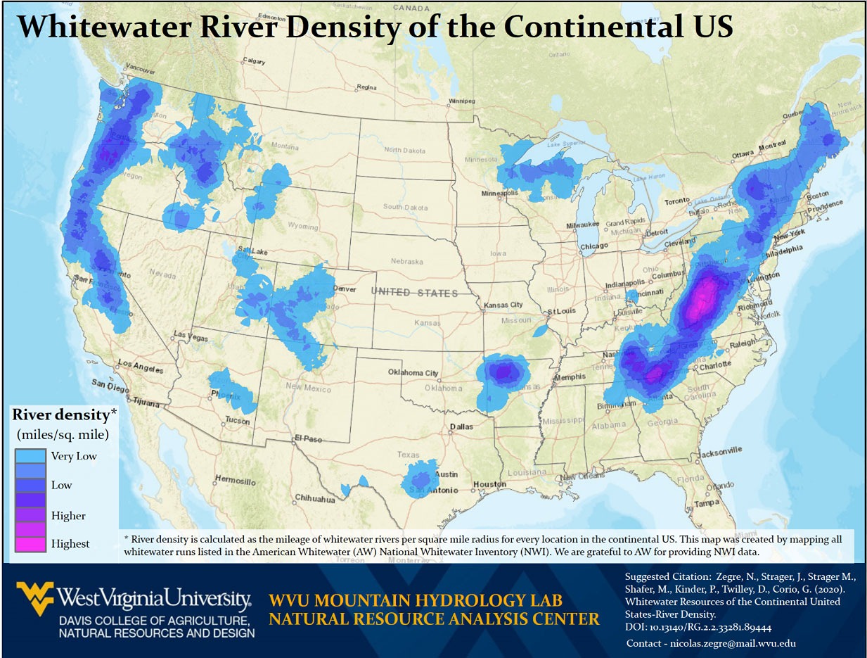
This map illustrates the density of whitewater rivers across the continental United States, based on data from the American Whitewater National Whitewater Inventory.
Areas shown in darker purple and magenta represent higher concentrations of whitewater mileage per square mile. The map highlights the central Appalachian region, particularly West Virginia, as having the highest density of whitewater rivers in the continental U.S., underscoring the state's exceptional opportunities for whitewater recreation and its importance as a destination for paddling and outdoor adventure.